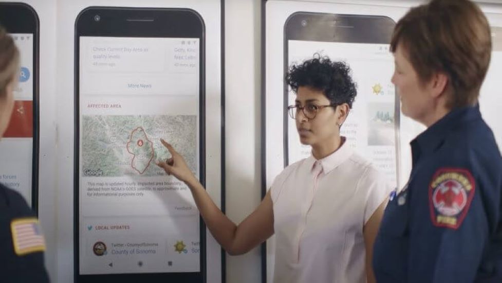
The News: As of this week, Google maps will track U.S wildfires as they continue to plague Colorado and California. This means Google search queries for information about the wildfires not only include new stories, but show a display map of the fires’ boundaries. In addition, the Google Maps app will also display the wildfires’ boundaries and provide warnings and ambient alerts to those who begin to approach affected areas. You can read Google’s post about mapping the U.S. wildfires here.
Analyst Take: Not only is Google displaying Colorado and California map boundaries, but more importantly, it is updating it by the hour to give users the most accurate view that it can. To do so, Google has been using Google Earth’s analytics tools to monitor imagery provided by the National Oceanic and Atmospheric Administration’s (NOAA) four GOES satellites. These satellites can see the plumes of smoke the fires produce as well as the sizable thermal hotspots that indicate areas of intense fire activity.
It is important to note that this isn’t the first time Google is using mapping to keep users updated on wildfires. Google piloted this map boundary feature during the wildfires in 2019, with input from emergency services officials in California and Colorado. Both emergency services gave feedback that the boundary feature would be helpful in 2020.
In his blog post, Google’s Crisis Response Lead, Yossi Matias, says that the National Interagency Fire Center is forecasting above-normal wildfire potential throughout the United States with a window of risk that extends at least through September. Google’s fire-tracking tool remains exclusive to the U.S., but as the potential for wildfires extends beyond the U.S. and into the Canadian wilderness, Google has said it will roll out this feature on an international level in the future. A feature like this would have been helpful during recent fires in Australia, Russia and Greece, so I’m sure an international release will be well received.
Google has been busy the last six months in quickly adjusting to world events. As I wrote about back in May, the tech giant adjusted its search engine to help identify nearby telehealth resources for users at the start of the COVID-19 pandemic. As a result, a search for health resources automatically pulls up clinics or medical practices that offer telehealth options. The fact that Google has been quick to market with these tools as these emergencies happen, shows the company’s humanitarian side for helping users and also shows off its agility as a tech company and solution provider. I think both the telehealth and fire trackers will be beneficial to end users and set precedent for more agile applications in the future.
Futurum Research provides industry research and analysis. These columns are for educational purposes only and should not be considered in any way investment advice.
Other insights from the Futurum team:
Google’s COVID-19 Shift: Adjusting Search and Maps to Identify Telehealth Sources
Google Announces Digital Job Training Program to Help with Economic Recovery
Google, Apple COVID-19 Contact-Tracing Partnership — A Look at the Good and the Bad
Image Credit: Google
The original version of this article was first published on Futurum Research.
Sarah brings 24 years of experience as an industry analyst to the Futurum team. She most recently served as the head of industry research for Oracle. Her experience working as a research director and analyst extends across multiple focus areas including AI, big data and analytics, cloud infrastructure and operations, OSS/BSS, customer experience, IoT, SDN/NFV, mobile enterprise, cable/MSO issues, and managed services. Sarah has also conducted primary research of the retail, banking, financial services, healthcare, higher ed, manufacturing, and insurance industries and her research has been cited by media such as Forbes, U.S. News & World Report, VentureBeat, ReCode, and various trade publications, such as eMarketer and The Financial Brand.

